 | ||
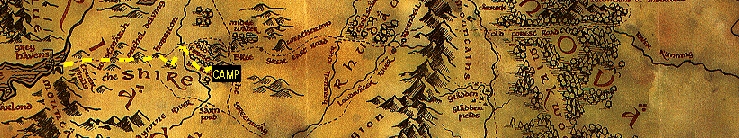
| Discover New Zealand, Home of Middle Earth | ||
 | ||
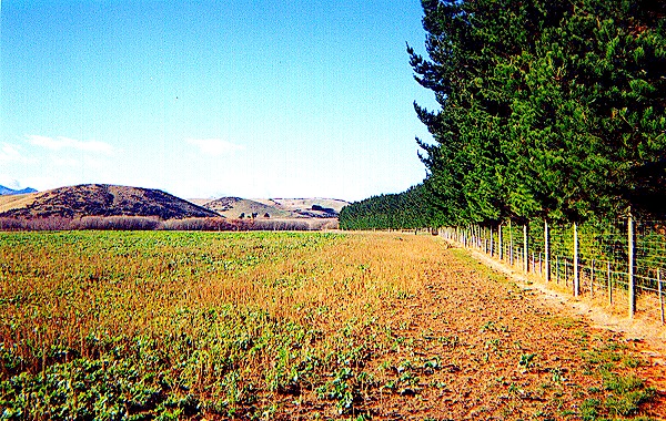
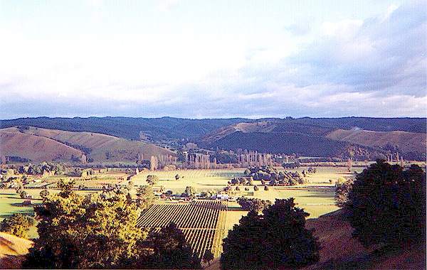 | The area at the western edge of Woody End is quite rugged. From this area one can look back over the Shire past Frogmorton, in the foreground of the photo on the left, to the wooded area of the Northfarthing and the small mining community of Brackenborings. The Water here is no more than a winding black ribbon, hard to see from far away. This was difficult terrain for the short legged hobbits, and they made only about six miles from lunch to the supper halt. | 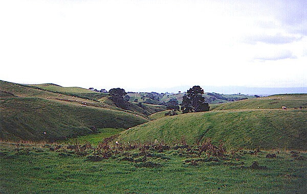 |
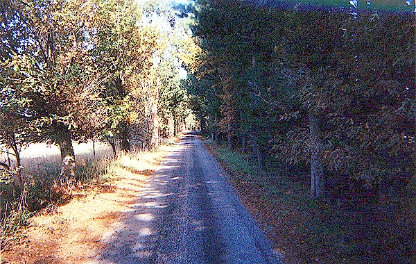
 | The hobbits had to stay in the rough, hilly country at the western edge of Woody End. If they had turned toward the north at this point, they would have run into the hedgerows near Stock, or found themselves in the swampy Marish, as Pippin pointed out to Frodo later on. There is a narrow winding road here. It is possibly used by the wheat and corn farmers from Stock and Woodhall, to the east, driving wagon loads of grain west to Sandyman's mill in Bywater. | 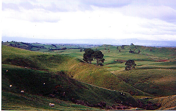 |
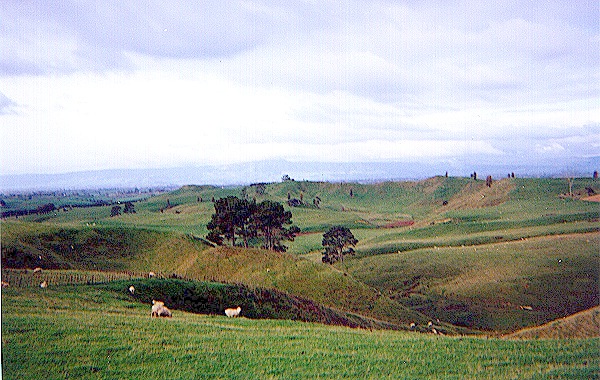
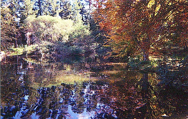
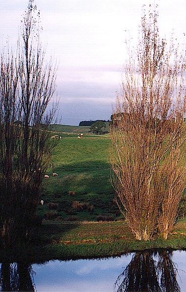 | This is the only place we could find where the hobbits might have stopped and filled their water bottles, although it is possible that this is a recent spring fed pond and others have since dried up. The water here is clear and icy cold.
The land here is more wild and woody, and there are many different trees and dead twigs and logs for firewood. The trees and hills make it difficult to see very far in any direction, which was very fortunate for Frodo, since the black rider could not see him before he heard it coming and got off the road. The road here goes up and down, following a path that is just barely wide enough for a small cart or very small wagon. | 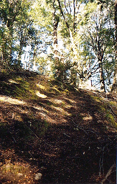 |
 | This is the place where Frodo heard the black rider coming and got off the road before it overtook them. It is not obvious from what direction the rider came, but it is likely that the tree in the photo on the right is the one under which the hobbits hid while the rider was sniffing for them. The road splits here, and as the hobbits were going down into a little hollow, the rider may have got their scent where they had been on the higher part of the road, not where they actually were! | 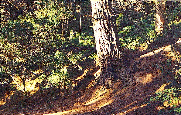 |
 | The photo on the left shows where the hobbits encountered the elves in Woody End. Since the elves preferred to travel in the woods, they were no doubt striking west through here, out of sight of the Great East Road, until they joined it at the south skirts of the White Downs. The hobbits continued along this road until they reached the greensward where they spent the night, shown in the righthand photo. Stefanie found a bench to sit on while I scouted around. | 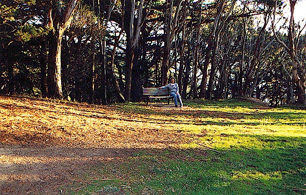 |
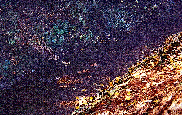 | The greensward is on the edge of a steep bluff overlooking the Stockbrook. (I lost my footing and fell down the bluff almost into the water.) The open land along the Stockbrook runs into the Marish, so the hobbits were forced to cut through the woods again. They turned too far south and came out suddenly on the lane along the hedgerows leading to the Maggot farm. On the other side of the lane are vast grasslands stretching toward the Marish. | 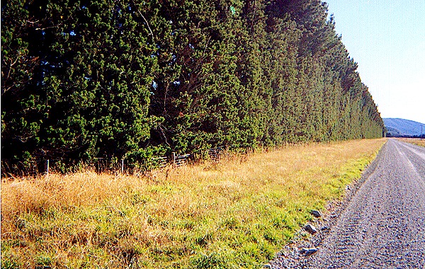 |
 | The lane to the Maggot farm is in good repair, but when we looked for the farm itself, all we found were ruins of a large house and farm buildings that once must have been imposing structures, stoutly built. To the north and south are the grasslands and fens of the Marish, while the Woody End comes to an abrupt end next to the farm lane, which itself ends suddenly just before the land becomes too soft to support a road. The lane could have been built for farm implements and wagons. | 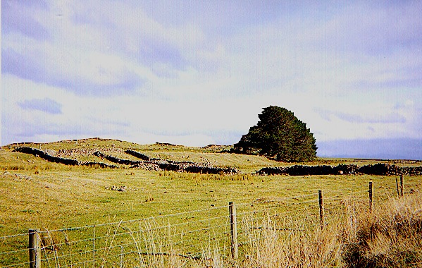 |
 | The other end of the lane leads to the causeway along the Maggot farm hedgerows. It crosses a substantial dike and intersects with the causeway road. The distance from the farm ruins to the causeway is about five miles, and another five miles or so to the ferry landing, in a little wooded area. The causeway runs along the western side of the Marish, as shown at the right, and only approaches the Brandywine at the ferry landing. | 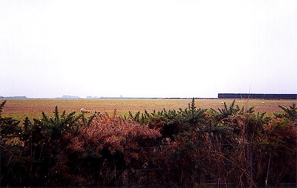 |
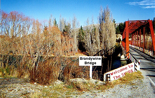 | The causeway runs through the Marish for about ten miles to the Brandywine Bridge, shown on the left. Merry said that the black rider would have to go twenty miles to the bridge, but I think he meant ten miles to the bridge and ten miles back to the ferry landing at Bucklebury, since he was surely familiar with the distances involved in this well-known area. There is a little tree lined road on the other side that goes south to Newbury and Bucklebury and then on to Standelf. | 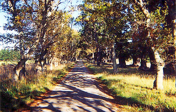 |
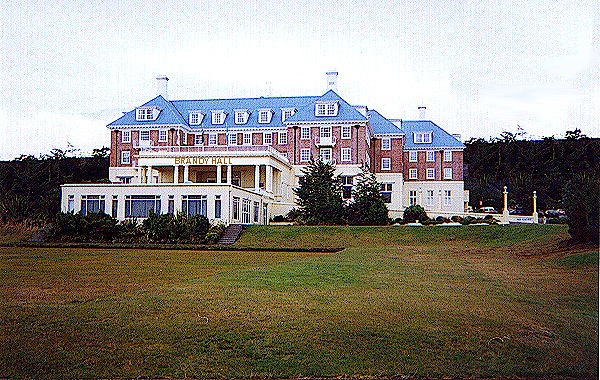 | Surely the most imposing structure in Bucklebury is the famous Brandy Hall, home of the Brandybucks and the Master of Buckland and now a luxury hotel. It is built on a low hill with a beautiful lawn in front of it that slopes gently down to the tree-lined ferry landing, shown on the right. Behind the Hall is Buck Hill, riddled with smials, and other hills and outbuildings of the village of Bucklebury. There is a major road there, and a smaller road that leads to Crickhollow and the Old Forest. | 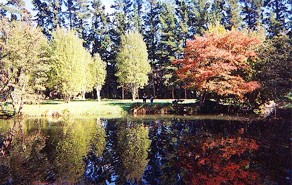 |
 | The road to Crickhollow continues on past the small farms and cottages of western Buckland. For most of its length, it is bordered on one side or the other by the hedgerows that resemble those of the Shire, although they are somewhat more sturdy and difficult to penetrate. The lane to Crickhollow is entered through a narrow gate in a thick hedge. We found the hedge and the gate, but it was locked and we didn't want to trespass, so we passed it by. | 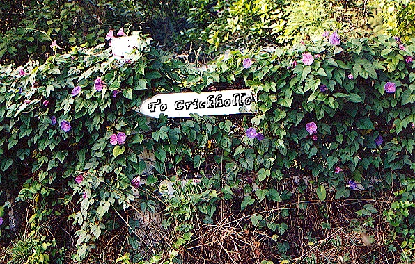 |
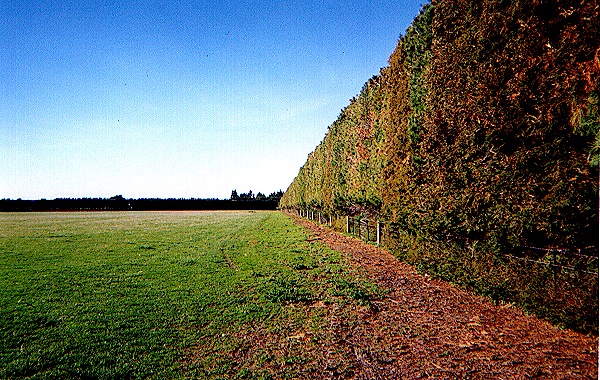
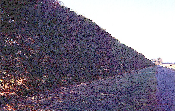
 | Buckland is separated from the Old Forest by a huge hedge, the High Hay. It is reinforced with a barbed wire fence in front and thick piles of brush and thorn bushes on the other side. We wanted to follow the journey of the hobbits, but it was afternoon and we felt that was unwise. We decided that we didn't want to take the chance of wandering around in the Old Forest at night, so we followed the High Hay past Standelf to the confluence of the Brandywine and Withywindle Rivers. | 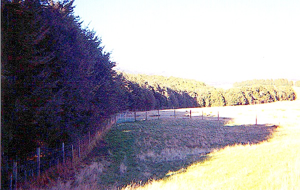 |
 | The Withywindle is a small, shallow river that empties into the Brandywine in a grove of trees that mark the southern edge of the Old Forest. The southwestern end is fairly open and flat, flanked on either side by reeds and brush, with enough space for a path on one side or the other. Later on it becomes overhung with trees as it flows through the Forest. We followed it warily, looking for Old Man Willow, or any of the "queer things" said to inhabit the this area, but all we saw were trees. | 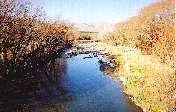 |
 | We followed the Withywindle to the eastern edge of the Old Forest. Here it runs down a short fall that marks the end of the Forest, Further on, it is fed by spring on a grassy knoll. Since the sun was setting, we decided to stop for the night. As we looked northward to the expanse of the Old Forest stretching before us, we were glad we had not taken that route, especially since we were now at a farm which we knew well from history, the house that once was the home of Tom Bombadil! |  |
Click here to go to Day 4 * Click here to send us e-mail | ||