 | ||
| Discover New Zealand, Home of Middle Earth | ||
 | ||
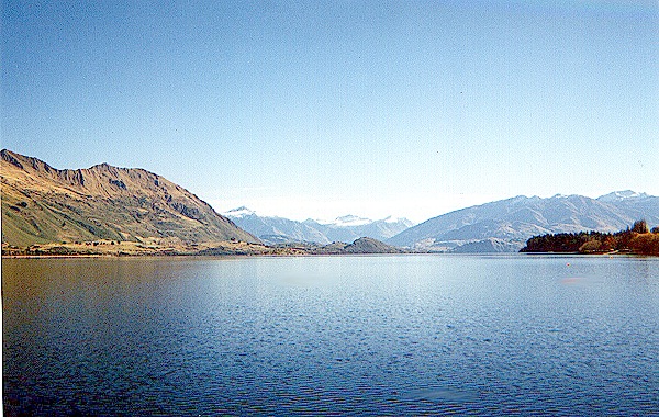 | We begin our journey at the entrance to what is shown on the maps of Middle Earth as the Gulf of Lune, but is correctly described in the text as a firth, or tidal estuary. It splits the Blue Mountains, or Ered Luin, and forms the outlet of the Lune (or Lhun) River. As shown in these photos, the Blue Mountains are really blue, no doubt due to salts of metal ores that have been mined extensively by the dwarves, some of whom still live here. Gimli was said to have been born here. | 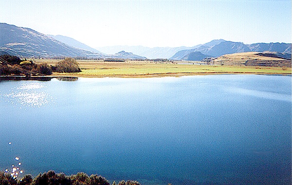 |
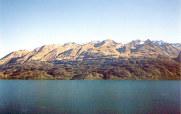 | The Grey Havens, where the elves last lived in Middle Earth, are along the eastern shore, perhaps in the location on the right. There is a wooded beach that might have been a good place for building ships, alongside a deep stream that may have been used to launch them, but there is now nothing like a harbor. The Ered Luin seem to have been torn in half by a giant earthquake. What could have caused such a tremendous cataclysm? | 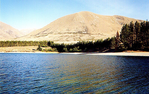 |
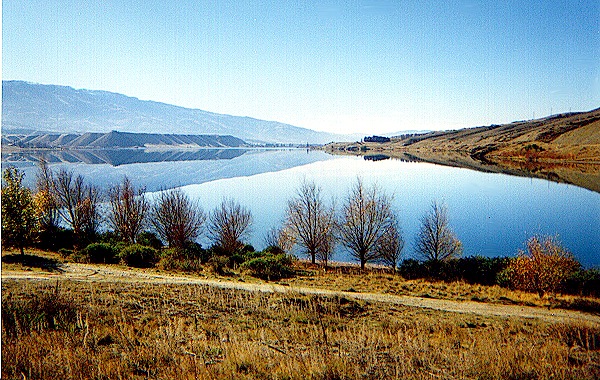 | There is a little tree-lined road along a dike next to the beach, and from the hills behind one can see the Gulf (or Firth) stretching south, and the Tower Hills to the east. This is the Westmarch, where elf towers once stood, from which one could see the Great Sea. The Great East Road runs through the Far Downs, an artificial forest that may have been planted as a source of timber for ships. The Ringbearers may well have come this way. | 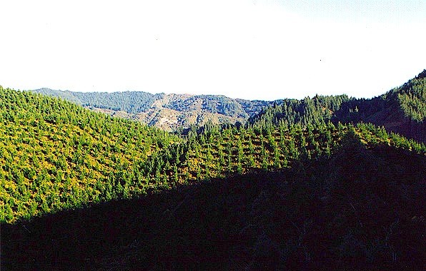 |
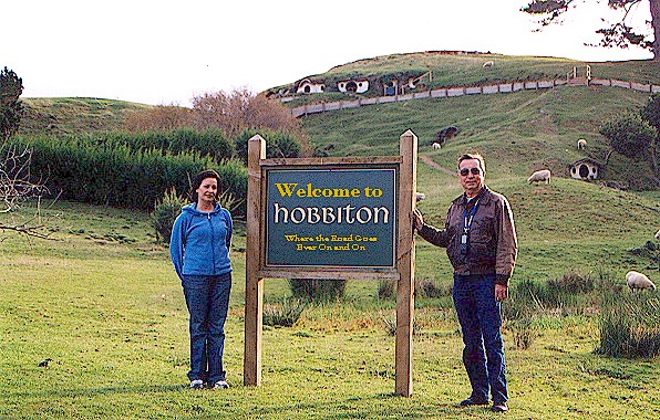 | We were unable to find Michel Delving or Waymeet (called "Waymoot" on the maps), but Hobbiton is very easy to recognize. The western edge is actually the "back door" of Hobbiton, and there is a little sign there from which one can plainly see The Hill and Bagshot Row. The hilly terrain is honeycombed with old, abandoned smials, indicating a cozy community of friendly neighbors and numerous (and sometimes pesky) relatives. | 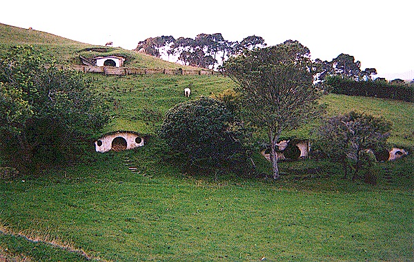 |
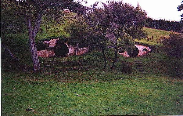 | Each smial has a large round front door and one or two small windows. Some of them have patios and stone stairways. Inside they twist and turn and branch into sitting rooms, dining rooms, pantries and bedrooms. We are fairly sure the smial on the right was Bilbo's, Frodo's and Sam's home (and for a short while the Sackville- Bagginses'), but it empty and abandoned now. What a terrible thing Sharkey (and time) did to the Shire! | 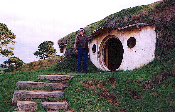 |
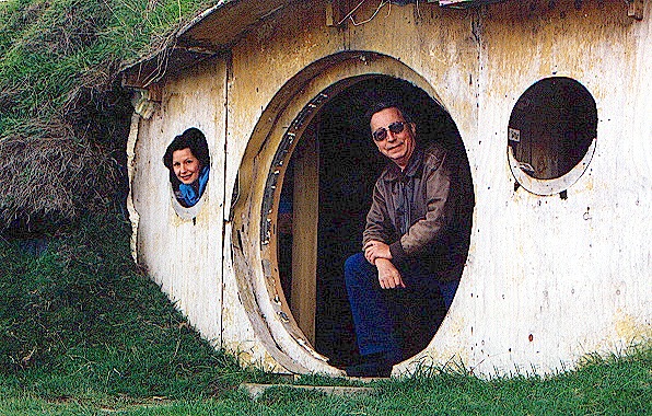 | We decided to take a look into and around Bag End. It may once have been very nice and cozy, but it is now dirty and damp, with an oozy smell, and there are no pegs for hats and coats. We had to hunch down to get inside, because the door is only chest high. From the front door one has an excellent view of the Party Tree and the lawn around it. It is still a lovely picnic spot where Bilbo could survey all his party preparations going on. | 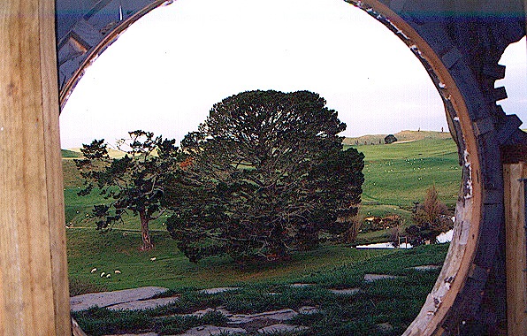 |
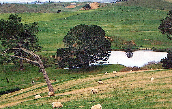 | The party area is about a half a square mile of not quite flat land with a small pond that makes a great watering place for farm animals and a reflecting pool for fireworks. In the left photo one can see a few houses along the Bywater Road, and in the right photo one can just see the road as it runs along the crest of a small hill. This is a good area for grazing sheep and the area is divided by very ancient hedgerows that effectively keep each sheep on its own property. | 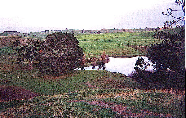 |
 | The Hobbiton area, left, is typical of the Shire country, lush and green. From the very top of The Hill one can see for miles, as shown in the right photograph, which looks northward past the Northfarthing town of Overhill to Needlehole on The Water and Oakbottom. The hilly area in the distance in the right photo is Bindbale wood. One can imagine Bilbo sitting under the tree at the top of The Hill gazing at this scene and smoking his pipe. Sam's numerous children probably played there, too. | 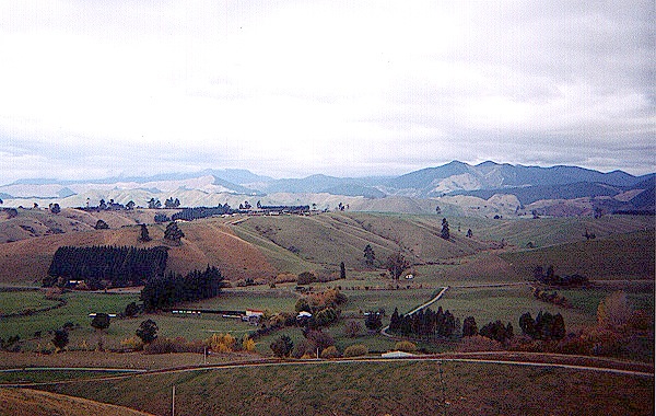 |
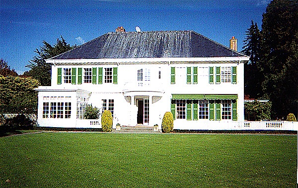 | The most impressive building in Hobbiton is the Old Grange, a hotel with magnificent lawns that set it apart from the metropolitan area of Hobbiton- Bywater, which is essentially one large town. The Hobbiton sign is actually in downtown Bywater. We didn't see any hobbits, but they are shy and fade quietly away from "the big people" as they call us. The town has a little league team that is said to be awesome, especially their shortstop, and the little theater group is well though of. | 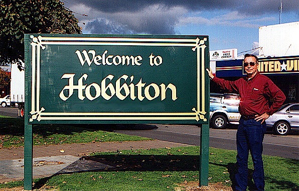 |
 | The Green Dragon Inn looks out on Bywater Pool. There are smials in the hills beside the pool. The Bywater road runs southeast past little farms; one of them may once have been owned by Farmer Cotton. It joins the Great East Road about four miles west of the Three Farthing Stone. The Stone itself is said to be near the center of the Shire, but this is true only north and south, because it is 36 miles from the Brandywine Bridge, but about 114 miles from the Lune. | 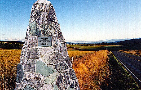 |
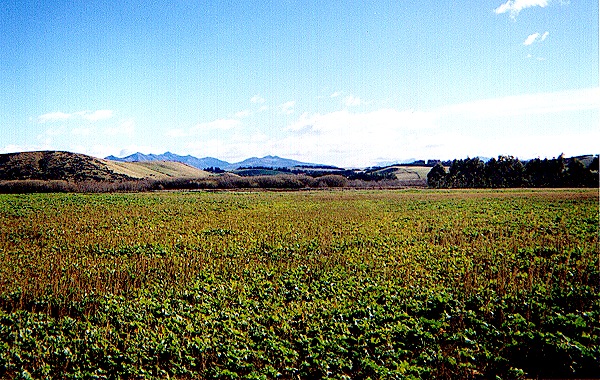 | The hobbits left the Great East Road and headed in a southeasterly direction, as shown in the left photo. The fields are sometimes brown with crops of grain, as shown on the right. There are many patches of firwood, and little gullies with scattered trees close to the water, where the hobbits ate and slept. The fields are well tended with an obvious concern for crop rotation and erosion management by people who are definitely lovers of good, tilled earth and all things that grow. | 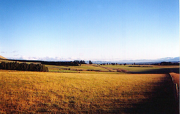 |
 | As one approaches the green hill country, the land becomes more rugged, with rock outcroppings here and there and little wooded creeks and streams. The hobbits therefore turned toward the east, along flatter land. They may have been trying to avoid trampling the cropland while at the same time keeping north of more difficult terrain. There is flat land all the way to the Brandywine, where it becomes the soft and boggy Marish, except for the slightly elevated town of Rushey. | 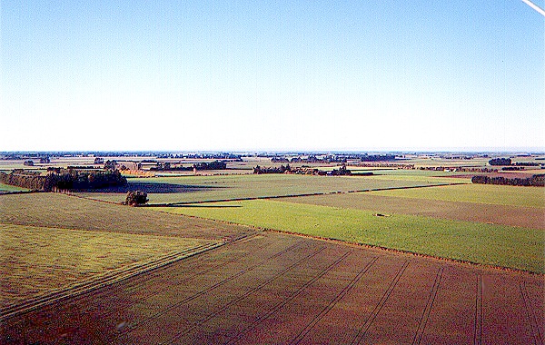 |
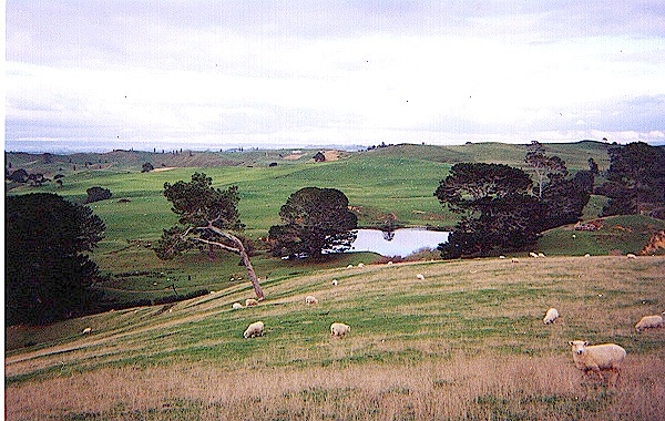
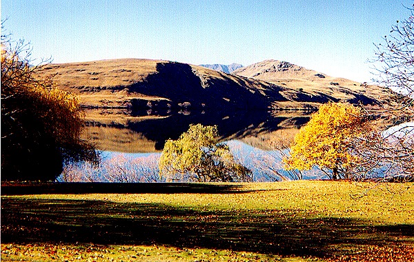
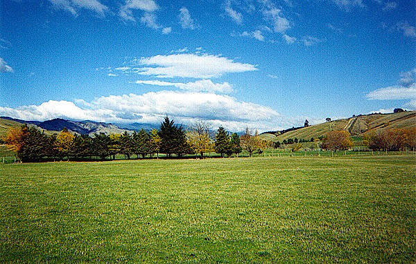
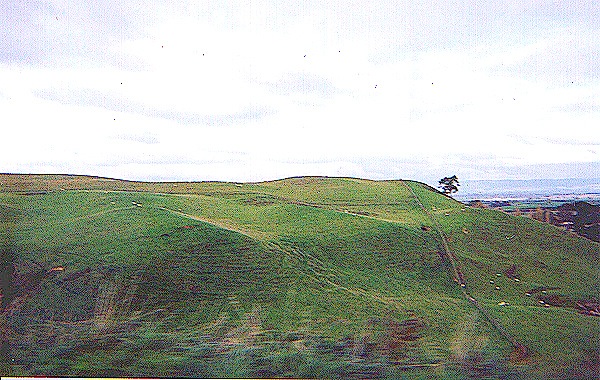 | This is almost certainly the "steeper hill" in the green hill country where the hobbits had lunch on the second day of their journey. There are no other hills from where one can see all the way to Woody End, where they met the elves and black rider. The hill itself is on the left, and the view toward Woody End is on the right. The land here is too hilly for farming, so the trees have been left standing and sheep graze on the grassy hills. We decided this was a good place to spend the night. | 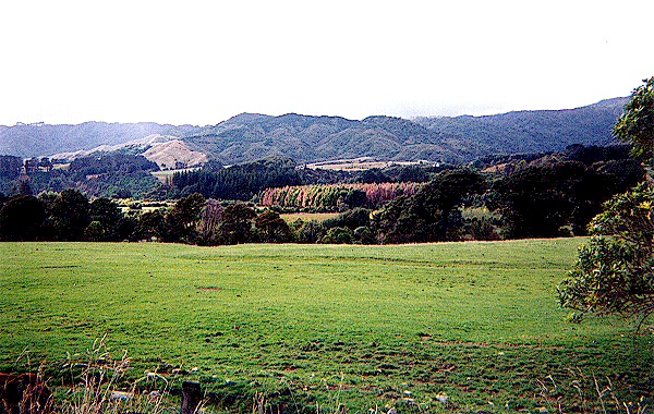 |
Click here to go to Day 3 * Click here to send us e-mail | ||