 | ||
| Discover New Zealand, Home of Middle Earth | ||
 | ||
 | There are many paths that lead up into the mountains from Rivendell, and many passes over them, but most of them lead nowhere or to bad ends. There is a wide, well traveled road through the High Pass, with a little tea room at the very top where one can sit on the porch and enjoy the view. Bilbo and the 13 dwarves actually came this way before they were caught by the orcs. We decided to follow the path taken by the Fellowship of the Ring south to the Redhorn Pass. | 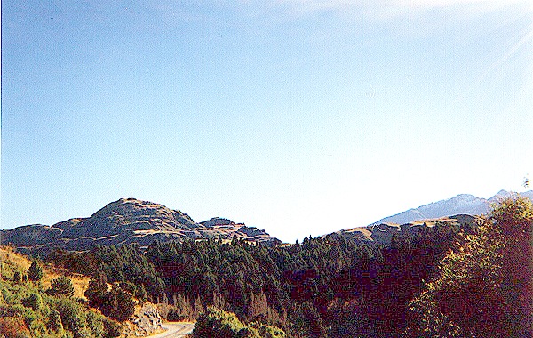 |
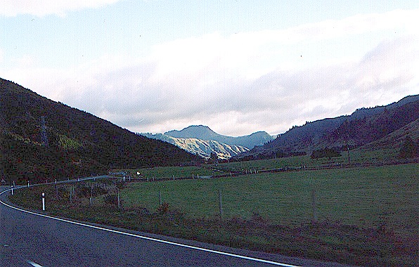
 | Because of their desire to keep out of sight, the Fellowship did not keep to the well-traveled main road, but followed the narrower paths that twist and turn as they follow the folded contours of the Misty Mountain foothills. The Bruinen here runs swiftly, gathering strength from the streams fed by the snows of the Misty Mountains and the springs fed by water trapped for countless eons in the labyrinth of caves beneath. It then swings westward to join the Hoarwell. | 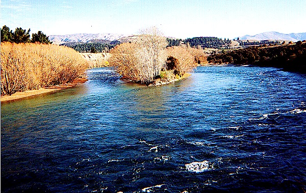 |
 | Cardolan, and Rhudaur, the parts of northeast Eriador, constitute a wild plain that makes cross country hiking, or "tramping," a difficult task for people with short legs. Aragorn therefore led the Fellowship through the "wild lands south of Rivendell" partly along the elf paths on the western slope of the Misty Mountains, along the east bank of the Bruinen. On the left is the view westward toward the hills of Rhudaur. On the right is the site of a ruined fortress shown briefly in the film. | 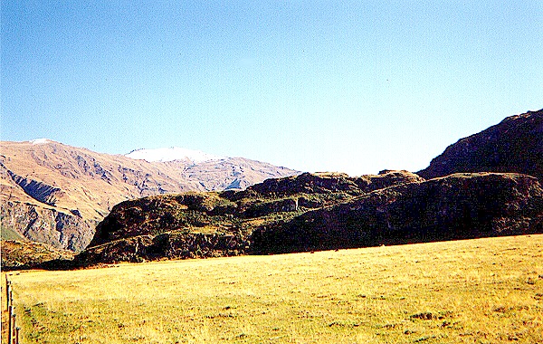 |
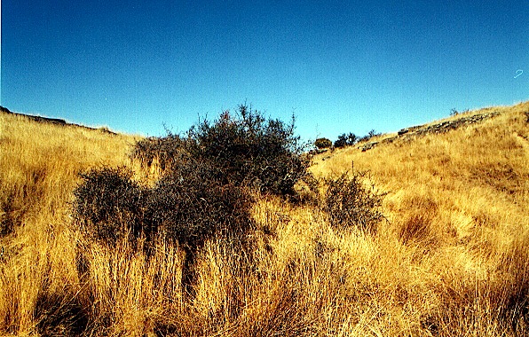
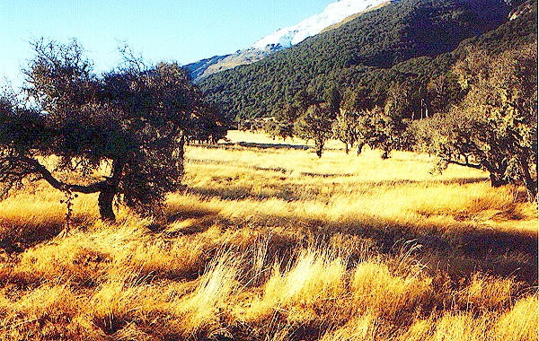 | The area at left is typical of the wild lands of Rhudaur. These extend south past the Old South Road into Eregion. Gandalf came through just such territory on his ride from Hobbiton through the Gap of Rohan to Minas Tirith to search the municipal library for information about the Ring. The area at right is one of the places shown in the film, where the Fellowship had to walk single file along the rocks and gullies that occasionally crossed their path. | 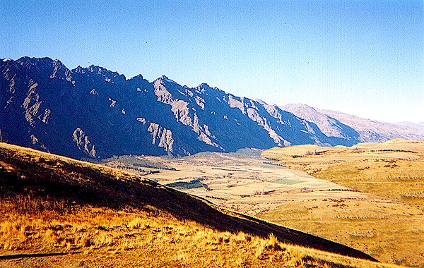 |
 | The Misty Mountains bend westward so that they seem to stand across the path of anyone traveling along their base. Because of their desire to stay off the main road, the hobbits found it very slow going. It is said that they covered a distance of 135 miles as the crow flies in fourteen days, in spite of Aragorn's and Gandalf's extensive knowledge of the area. Their actual speed was probably much faster, since their path along the foothills was anything but straight. | 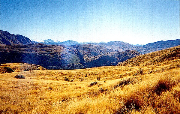 |
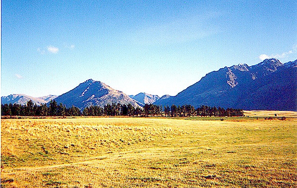
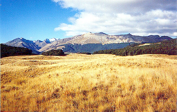 | The Fellowship's journey took them southwest almost to Eregion, or Hollin, shown in the distance on the left, known for its holly bushes. They never quite reached it because they struck the road east of Eregion that leads to the Redhorn pass. There are no other passes across the mountains from this point until the Gap of Rohan, 210 miles to the south. The road today is a hard, gravel road, well drained, that looks as if it is well maintained and frequently used. | 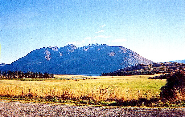 |
 | Just before the path turned northward, we found an area of thorny bushes that looked a little like holly but were brown and had no berries. These bushes make an effective barrier to travel unless one goes single file and is careful to avoid them. Perhaps this is why there is a road here that joins the road from Rivendell to Dunland that skirts Eregion on the west side. The road here turns left and runs toward a cleft in the Misty Mountains, the Redhorn Pass. | 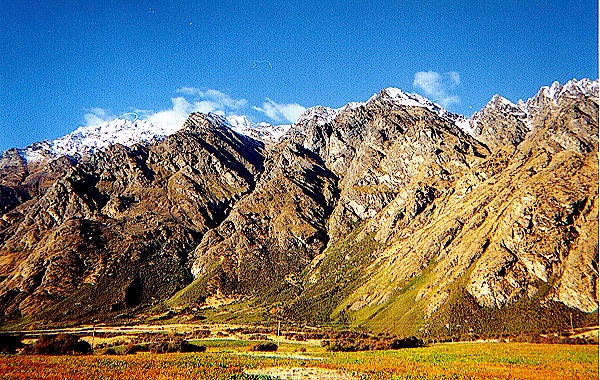 |
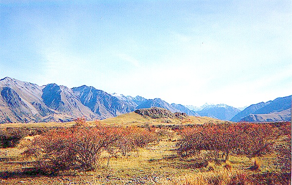
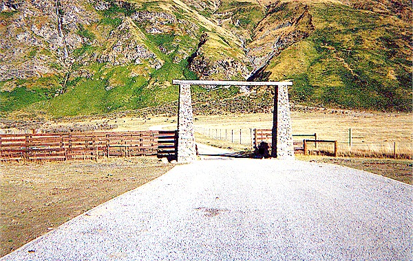 | The Redhorn Pass is also known as the Redhorn Gate, and we were surprised to find a real gate where the road leaves the flat plain and begins its tortuous path through the Pass. Here it becomes narrower, but is still well drained and able to support heavy traffic. Dwarves used to live in this region, and many of their works of art are said to portray images of the mountains and surrounding features. Perhaps they built the ancient, well-planned road, long ago. | 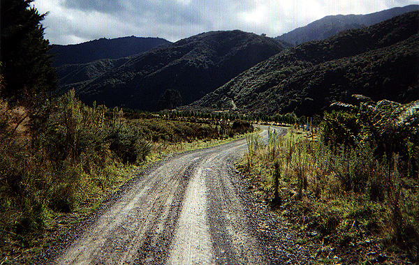 |
 | The road winds around the northern side of the Pass, following the contours of the land that makes it seem almost level as it climbs up toward the cleft between Caradhras (Redhorn) to the north and Celebdil, or Silvertine, to the south The Dwarves call these peaks Barazinbar and Zirak-zigil, respectively. Once on the slopes, it is possible only occasionally to see the peaks; the road seems to just go ever on and on, twisting and turning through hills crowned with trees and bushes. | 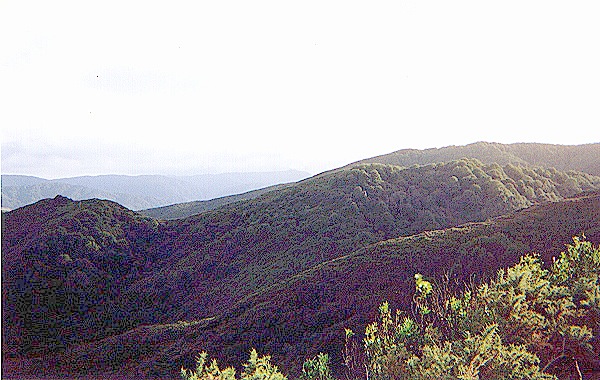 |
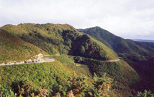
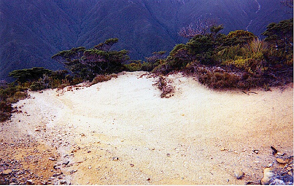
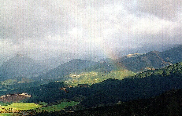 | Looking down from the heights one can see the plains of Rhudaur. They look much more green from here than they do when one is actually on them. Also obvious from this photo is the perpetual cloudiness for which the Misty Mountains are named. In the clear mountain air one can see the snow-capped peaks that alert us that we are in fact getting closer to the top of the Pass. The road at this point is less well maintained, perhaps less frequently used as well. | 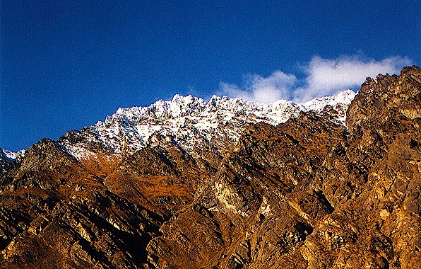 |
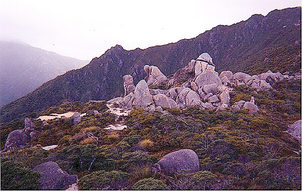 | We recognized this spot as the place where the Fellowship stopped and camped for the night, and where they saw the Crebain from Dunland. It is not quite at the top of the pass, but close enough for one to believe he has finally reached it. There are stones sticking up out of the ground all over; not just lying about, as if they had come tumbling down the mountain, but actually stuck in the ground, as if they had been thrown from a great height. | 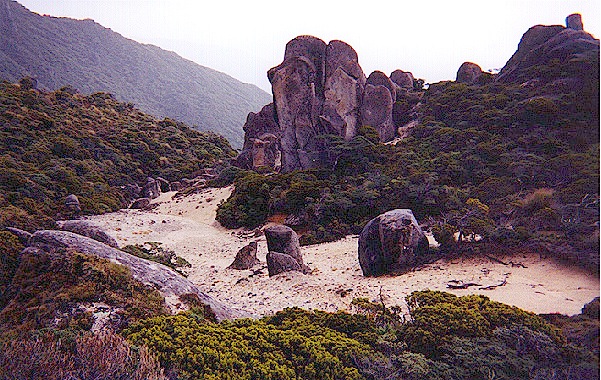 |
 | This is the area shown in the film where Boromir taught Merry and Pippin how men fight with swords, and where Merry and Pippin taught Boromir and Aragorn how hobbits fight with anything handy. We felt that the Fellowship had chosen a good place to camp, and since we weren't worried about unnatural storms, we decided to imitate them. As the sun set we looked back across the mountains at the long way we had come from the beautiful land of Rivendell. | 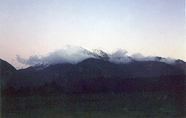 |
Click here to go to Day 7 * Click here to send us e-mail | ||